© 2018 Dr. M. Sheppard
The climate is described as continental and semi-
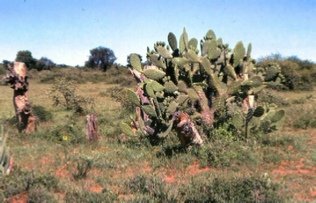
December and January are the hottest months. when temperatures may rise as high as 40 degrees Celcius. During the dry winters, although the days may be warm and sunny, the temperatures can drop below freezing during the nights and in the South frost is not uncommon. The natural vegetation of this area is mostly tree or shrub savanna with some grass savanna. In areas where cattle are introduced scrub savanna tends to spread due to a tendency towards over-
Thus the question arises as to why an agricultural (livestock and arable) people like the Batswana. were attracted to this semi-
By the 1981 census there were still less than 1 million people who are composed of 8 main tribal groupings and a number of minor ones. The Batswana belong to a Bantu language group and are classified as Western-
During the 16th century fission led to Batswana settling further West into areas around the modern Zeerust, and to the North where they encountered the Bakgalagadi, whom they either incorporated or pushed further West into the Kgalagadi Desert. The Bakwena, who are reputed to be the first main Tswana tribe, probably crossed the Notwane River in the 17th century and were certainly well-
Up to about 1750, settlement of Botswana was mainly to the East of the modern railway line, the rest of the Kgalagadi being very sparsely populated by Basarwa and later by the Hottentots. Of the Batswana, the majority were Bakgalagadi peoples who were mainly cattle herders and hunters, who moved as necessary in search of grazing and hunting areas.
By the 1800 peoples had settled all around the Kalahari Desert and all areas with permanent surface water were occupied by the cattle owners.
During the 1820's a new expansion into the area took place, mainly caused by the Mfecane following the Zulu expansions in South-
Dr. Andrew Smith, who travelled through the area in 1835, reported that the country was greatly devastated, with very few of the Batswana left in their traditional areas. They were subsisting on the dregs of hunting and thieving". (Alec Campbell quoting Smith in “A Guide to Botswana” P. 144)
There were many such incidents, these Transvaal Boers would never define their Western boundary nor recognise any Batswana ownership of land. By the 1870's and 1880's the Batswana had been evicted from most of their most fertile areas. The missionaries advised the various independent tribal groupings to unite against the Boers and seek the protection of the British. One, John Mackenzie -
This was very unsatisfactory administratively for the Protectorate. There was a great influx into the area of whites, who did not fall under customary tribal law. One reason for this was because of Cecil Rhodes' ambitions, particularly on mineral prospecting concessions. In 1893 Rhodes, following the suppression of the Ndebele Rebellion, took control of Rhodesia and in 1894 made an offer to administer the Protectorate for £50,000 per annum. The Chiefs having witnessed with horror what had happened to the Matebele were greatly opposed to this. The L.M.S. missionaries then helped to arrange for the 3 largest tribes to send their Paramount Chiefs to England, to campaign personally that they should become under British protection. In 1895 Sechele of the Bakwena, Khama of the Bangwato and Bathoen of the Bangwaketse, visited England. Their visit was successful, British Protection continued and they thus avoided either being incorporated by the Boers or being administered by Rhodes' B.S.A. Company.
Until September 30th 1966 Botswana remained a British Protectorate. The British Government wanted the area administered as cheaply as possible. Apart from a strip of land in the East for the railway line linking South Africa and Rhodesia (built in 1896-
During the British Protectorate there was a Resident Commissioner responsible to a High Commissioner. The country was divided into 12 administrative districts, each with a Resident Magistrate. However most of the traditional judicial powers of the Chiefs were at first left more or less untouched and the Resident Magistrate dealt only with cases that involved whites, and those African people from other districts. In 1919 they were also given jurisdiction to deal with appeal cases from the traditional courts. In 1926 jurisdiction over inheritance involving people married by Christian rites was added. Otherwise, especially day-
From the late 1920's Colonel Charles Rey became Resident Commissioner for eight years. Under him there were certain changes. For example the Promulgation of African Courts and African Administration Proclamation regularised the activities of the tribal courts and magistrates assumed the powers of District Commissioners. Their new duties included supervising the new Tribal Finance Committees. This had the effect of limiting the powers of Chiefs as tribal funds now had to be used only on projects approved by the D.C.s. During this phase social services were developed, for example, primary schools were increased by 65% and pupils by 100%, there was an 800% increase in out-
In 1961, in preparation for independence, a new constitution was conferred on the Protectorate, providing for Executive and Legislative Councils. In 1963, constitutional discussions were held and the new capital Gaborone was built, the administration was transferred from Mafeking. The General Elections took place on March 1st, 1965, bringing the Botswana Democratic Party into power, and their leader, Seretse Khama, became the first Prime Minister. On September 30th, 1966, Independence was granted and Sir Seretse Khama became the First President.
The Botswana Democratic Party (B.D.P.) has remained in power ever since. In 1977 there were 27 B.D.P. M.Ps and. in the opposition -
Although the opposition is small, Sir Seretse Khama greatly resisted requests that he should become a Life President like the Presidents of various other African countries. In 1980 following the death of Sir Seretse Khama, the Vice-
By the constitution M.P's are elected by universal adult suffrage. The ruling party's leader is the President, the Head of State. Chiefs have powers comparable to those of the House of Lords and meet at the House of Chiefs. Their main function is to advise on customary law. One of their recent contributions has been on customary marriage, couples married in this way now receive certificates so that they can qualify for married accommodation in, for example, the new mining towns.
Economic Development in all sectors has been the aim of the Botswana Government since independence. At independence there were 251 primary schools,with 71,546 pupils, and 9 secondary schools, with 1,565 pupils. Also there was a small trade school with 60 pupils. There was a chronic teacher shortage and 50% of the primary teachers were untrained. In fact only 25% of the population received any education at all. Only 20% of the primary leavers could find secondary places so there was a great shortage of all trained personnel. By 1978 there were 130,000 primary pupils and 17 secondary schools (either grant-
Males Females
At birth 52.5 years 58.6 years
At age 40 71.2 years 73.7 years
At age 60 75.6 years 78.2 years
The first whites to come to the area were the traders, hunters and missionaries. As early as 1802 the British Government at the Cape had sent representatives to investigate the possibilities of trading for cattle. From some of the journals and drawings of these early whites (the artist Samuel Daniell travelled in this area around 1802) arises a picture of the Batswana as a "peaceful people living under civilized and prosperous conditions". (Alec Campbell op cit. P. 145.) Burchell (1812) described a Tswana town as a "collection of villages, each a miniature replica of the whole town, since it combined a number of smaller villages composed of related families” (Alec Carnpbell op Cit. P. 145.) These towns were estimated as having between 10,000 -
John Campbell of the London Missionary Society (L.M.S.) was the first missionary to the Batswana, at Tlhaping, in 1813. Two other missionaries, Hamilton and Read, arrived later and all three went with the Batlhaping when they moved to Kuruman. The famous Kuruman mission was established in 1817. It was from here, under Robert Moffat, that the missionary movement spread North. Moffat wrote Setswana down and also translated the Bible into Setswana. Most of the major tribal groupings requested resident missionaries from this mission when they saw the benefits they brought, particularly in the fields of education and medical services. For example in the 1840's David Livingstone built a house in Kweneng among the Bakwena, and became a friend of, and converted, Chief Sechele, the Paramount Chief of the Bakwena. The missionaries were particularly useful as advisers to the Chiefs in their increasing dealings with other whites for example, the traders, hunters, Boers and British. They would advise them on the type of trading to limit or outlaw, and against granting prospecting rights or land. This was very useful as the Boer expansion became an increasing threat during the 19th century, as did incorporation by the British South Africa Company under Cecil John Rhodes.
Following the Great Trek North (1835 onwards) of the Afrikaans-
Background
This study focuses on the Bangwaketse people in Kanye, Botswana, during the late 1970s and early 1980s.
A BRIEF INTRODUCTION TO BOTSWANA
Botswana, formerly the Bechuanaland Protectorate, gained independence from Britain on September 30th 1966. It is a landlocked country situated at an average altitude of 1000 m on the Central African Plateau. It is bordered by the Caprivi Strip, Namibia, South Africa and Zimbabwe, and has a "pin-


The first of this language group actually to settle in Botswana were the Bakgalagadi around 1400 A.D. Previously the region had been only very sparsely populated by the hunting and gathering Basarwa, also known as the San or Bushmen, who belong to a different language group -
Traditionally they were hunters and gatherers, unlike the agricultural Batswana. Basarwa settlement in the area probably dates back as far as 10,000 years.
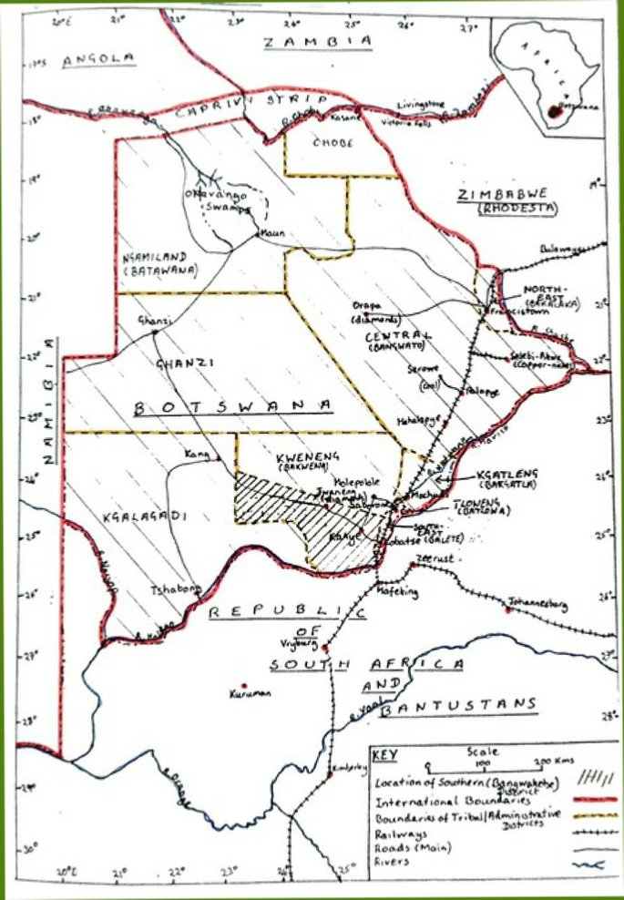
Typical Kalahari vegetation. N. B. This is after the Rains -

These are modern day Basarwa living in the Khutse area of the Kalahari. Many have intermarried with the Bakgalagadi. They are experts not only in hunting but also sourcing water from tuberous roots and other water bearing plants.

Demonstrating these skills to secondary school children from Kanye
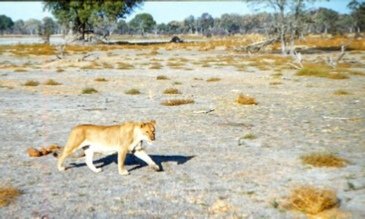
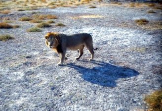
Kalahari lions roaming on a salt pan -
During the 1950's and 1960's various economic surveys for the Colonial Office showed that the Protectorate was still one of the world's poorest countries, and lacked many services, for example, water shortage was a constant problem; there were virtually no secondary schools, primary schools suffered from lack of trained teachers (only 50% were trained); there were only a few kilometres of tarred roads; a few all-
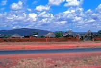

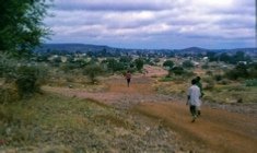
Typical roads. Although initiation had been abolished when the Chiefs became Christians, Age Regiments were still called and undertook group work such as constructing these all-
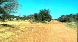
The tarred main road from Lobatse via Kanye to Jwaneng was constructed in the early 1980s
Further Reading:
Alec Campbell “ A Guide to Botswana” (1979) Winchester Press, Johannesburg and Gaborone